Climate Change
Feb 26, 2026
The Numbers Don’t Lie: Why Cities Can No Longer Afford to Ignore Climate Resilience
From rising flood costs to heat-related losses, the data behind climate risk is reshaping how cities plan, invest, and grow.
Climate Change
Feb 26, 2026
From rising flood costs to heat-related losses, the data behind climate risk is reshaping how cities plan, invest, and grow.
Climate change is no longer a future risk. It’s a present cost. And for cities across South and Southeast Asia, the bill is already arriving — in flooded infrastructure, displaced communities, and stalled development pipelines. The question isn’t whether to act. It’s whether cities can afford to wait any longer.
Over 800 million people in urban areas worldwide are currently exposed to at least one climate hazard — whether coastal flooding, extreme heat, water scarcity, or landslide risk. In India alone, more than 60% of cities are located in high or very high disaster risk zones. Yet most urban master plans still treat climate as an afterthought rather than a design parameter.
The economic cost is compounding. The World Bank estimates that climate-related urban losses could reach $314 billion annually by 2050 if cities continue on their current development trajectory. Every year of delayed action narrows the window for low-cost adaptation.
Extreme heat rarely makes headlines the way floods do — but it is consistently the deadliest climate hazard in urban areas. India lost an estimated 75 billion hours of outdoor labour productivity to heat exposure in 2021 alone. In dense cities with high surface impermeability and limited tree cover, urban heat islands amplify already dangerous temperatures by 3–5°C above surrounding rural areas.
The good news: heat is highly mappable. Land surface temperature data, combined with green cover analysis and demographic vulnerability layers, allows planners to identify the most exposed neighbourhoods and prioritise targeted interventions — cool corridors, shade infrastructure, and reflective surfaces — where they matter most.
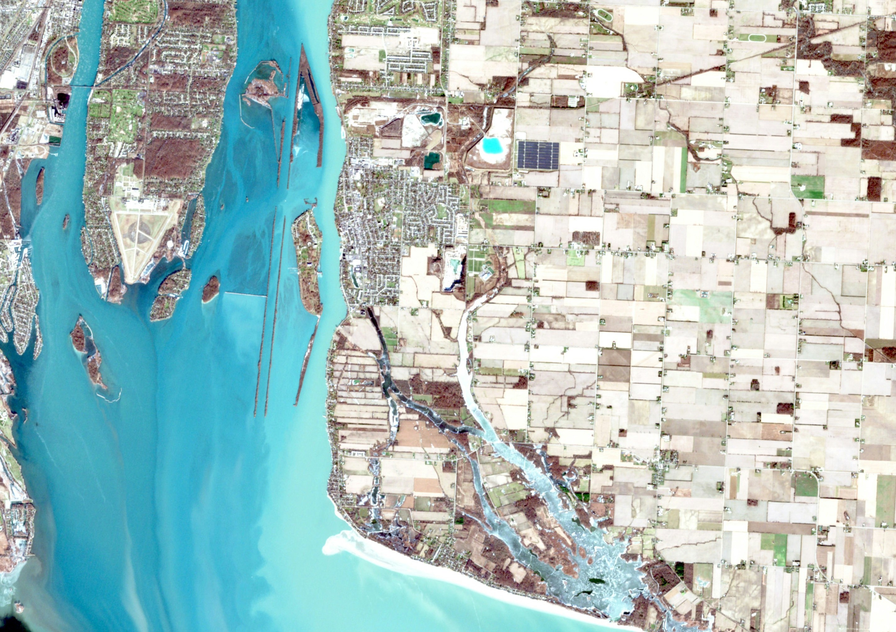
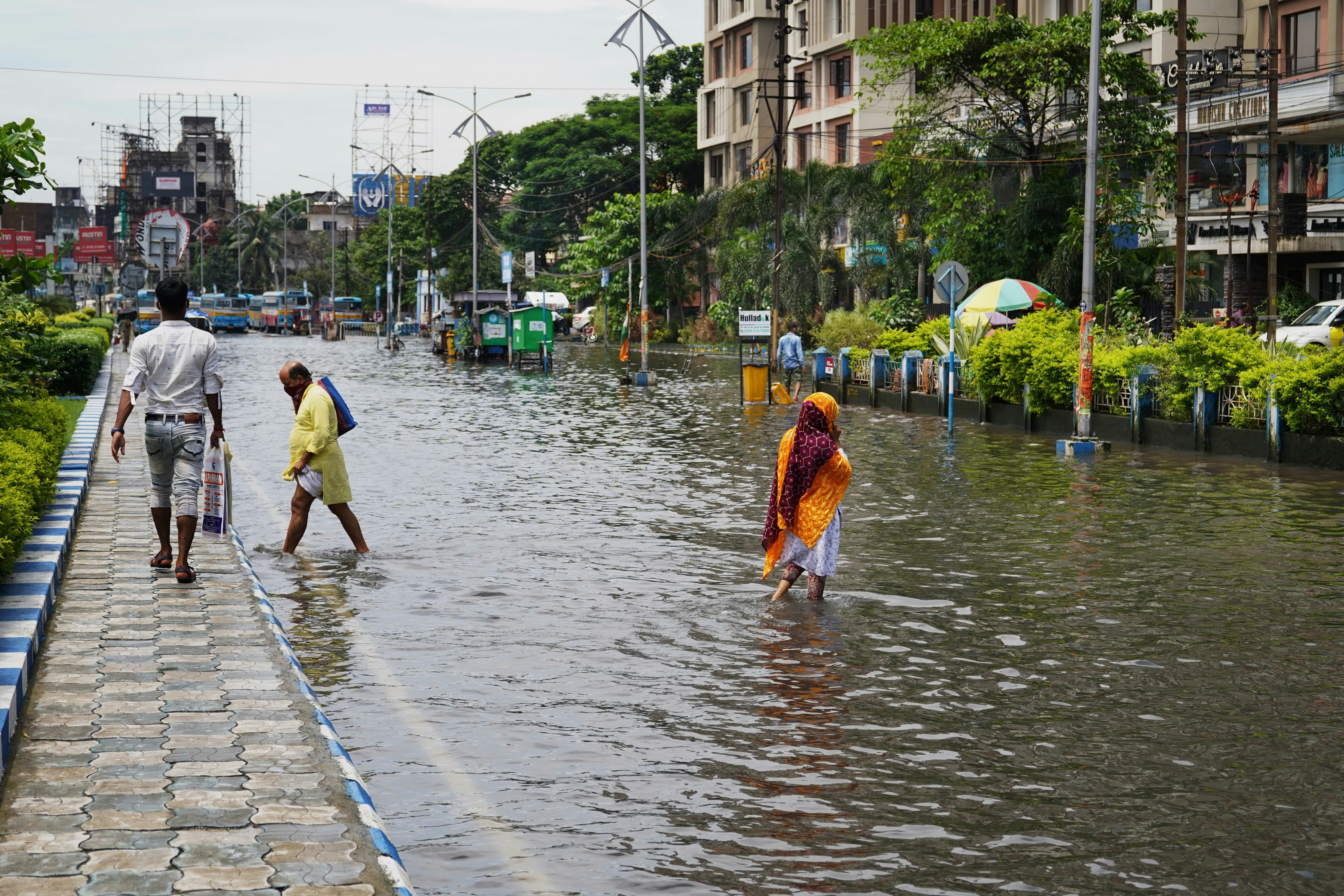
Traditional flood mapping relies on historical river data. But urban flooding today is increasingly driven by surface runoff, overwhelmed drainage systems, and encroachment on natural water bodies — none of which show up adequately in legacy models. A 2023 analysis of Indian cities found that over 40% of flood-affected areas in recent extreme rainfall events fell outside officially designated flood zones.
This isn’t just a planning gap. It’s a liability. Infrastructure built in unrecognised flood risk areas faces premature deterioration, insurance exposure, and potential displacement costs that dwarf the original investment.
The cities making measurable progress share a common approach: they treat climate data as core infrastructure, not a consultancy add-on.
They are integrating multi-hazard risk layers into land use decisions from the earliest stages of planning. They are using scenario modelling to stress-test infrastructure investments against 2050 climate projections, not just historical baselines. And they are building nature-based buffers — restored wetlands, urban forests, permeable surfaces — that deliver resilience at a fraction of the cost of engineered solutions.
The data is clear: every rupee invested in climate adaptation today saves an estimated ₹4–7 in future disaster recovery costs.
Infrastructure built today will still be in use in 2060, 2070, and beyond. Decisions made in the next five years will lock in either resilience or vulnerability for decades. The cities that build climate intelligence into their planning systems now will be the ones that attract investment, protect communities, and remain functional as conditions intensify.
At Planerth, we help cities and developers move from exposure to action — using spatial analysis, climate modelling, and integrated planning to build places that are ready for what’s coming.