
Enhancing Disaster Resilience in Hill Towns through Optimal Open Space Planning
How GIS-driven open space analysis is helping Gangtok build a safer, more resilient city before the next disaster strikes.
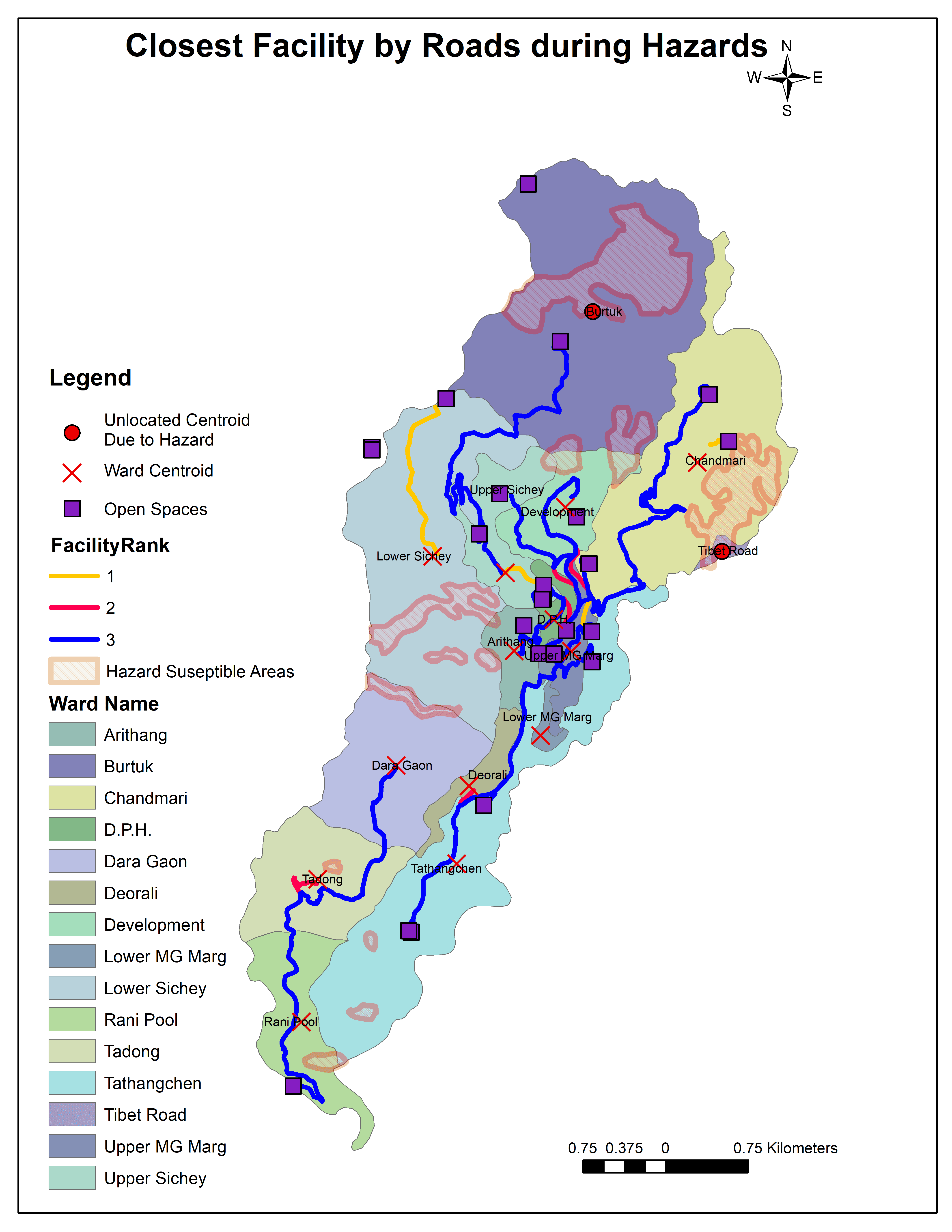
Gangtok sits in one of India’s most seismically active zones. With a population of over 100,000 and a zigzag road network carved into steep hillsides, getting people to safety during a disaster isn’t straightforward. This study investigates whether Gangtok’s open spaces are truly ready to serve as disaster response assets — or just green patches on a map.
Most of Gangtok’s wards fall drastically below the national recommended standard of 10–12 sq.m of open space per person. Five wards have none at all. When landslides hit, southern roads get cut off entirely, leaving thousands with no accessible refuge. This research used GIS network analysis to map the reality — and point toward solutions.

Challenges:
∙ 5 wards with zero open spaces
∙ Majority of wards below national per capita standards
∙ Landslides cut off southern road networks during hazards
∙ Peripheral wards face 60+ minute travel times to nearest open space
Our Solution:
∙ GIS Network Analysis to map real-time accessibility
∙ Closest Facility Routing under hazard conditions
∙ Service Area Mapping across all 16 wards
∙ Weighted Suitability Scoring (infrastructure, ownership, access, openness)
∙ Critical emergency route identification across GMC
Key Results & Impact:
Following the analysis, the study delivered a clear picture of where Gangtok is vulnerable and what needs to change. Central wards perform well — but the city’s edges are dangerously underserved.
Maximum travel time to open space.
62 minutes
Identified with zero open space coverage
5 wards